Environmental Services
Soils (pedology)
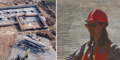
Geophysics & geotechincal surveys
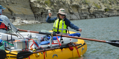
Water (hydro- & geohydrology)
Specialist scientific surveys for all scope of soil studies. Compliant (Soil Taxonomic System) and EU (FAO and EuDASM).
- Pedological mapping (baseline), Land Use and Land Capability
- CSM (monitoring & remediation)
- Soil management & rehabilitation plans
- Reserve determination
- Geospatial based mapping & records
- Riparian and wetland health surveys
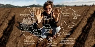
- Dr. Elaine’s™ Soil Food Web Approach
Water (hydro- & geohydrology)
Geophysics & geotechincal surveys
Water (hydro- & geohydrology)
Over 20 years of experience, with monitoring programs (sampling, establishing and development), toxicity analysis and remediation planning. We'll also site your potable water boreholes.
- Groundwater reserve determination (including safe yields and abstraction rates)
- Surface water quality monitoring (physical) assessment (organic and inorganic analysis)
- Borehole siting (geophysical surveys) and construction supervision
- CSM including NAPL and dNAPL (monitoring & remediation)
- S-P-R pollution management
Geophysics & geotechincal surveys
Geophysics & geotechincal surveys
Geophysics & geotechincal surveys
Qualified in the use of a series of underground and remote sensing technologies.
- Caesium Magnetometer (G850x), Electromagnetics (EM34x) and Electrical Resistivity and Gravimetric
- Ground Penetrating Radar (GPR)
- LiDAR
- Borehole loggers & cameras
Uses include potable water supply, establishing monitoring programs, mine dewatering, pollution abatement and control screens, fracture identification and preferential flow pathways (S-P-R).
Sub-surface excavations and analysis for
- Reconnaissance geotechnical excavations and surveys(*)
- DCP compaction studies
Certifications
Climate scenario modelling
Geophysics & geotechincal surveys

In-house professional certifications
- Professional Natural Scientist (Pr.Sci.Nat.) 2007
- Public Participation Specialist (IAP2) 2008
- Qualified Person Statement (PEA) (Canadian NI 43-101 for environment & social) 2016
- Green & Sustainable Finance Professional™ (Chartered Banker)* 2021
- En-ROADS Climate Ambassador™ (Climate Interactive)* 2021
In-house Languages
- English - native
- Afrikaans - native
- Dutch - fluent
Global reach
Climate scenario modelling
Climate scenario modelling

EarthPLAN has gained global technical specialist experience. Our work in EMEA has included extensive Southern Africa exposure in the mining & minerals, hydro- and geohydrological, forestry, agricultural, and the built environment sectors. Notable work in West Africa (aluminium) and East Africa (water & renewables). Our European experience includes planning design for faunal enrichment and new business establishment building on over 20 years of consulting work.
Our collaborations in the AMER, include legal reviews and Competent Persons Statements (supporting their IPOs) for clients and partners. Work in the APAC regions includes Hong Kong (financial and planning), Singapore and Malaysia (large and mega-scale industrial).
Climate scenario modelling
Climate scenario modelling
Climate scenario modelling

Do you want to see what the Climate Science impacts (risks) are, what the costs are or even how your coastline will change? En‑ROADS will get you there.
En‑ROADS is a global climate simulator that allows users to explore the impact that dozens of policies such as electrifying transport, pricing carbon, have on hundreds of factors like energy prices, temperature, air quality, and sea level rise.
Developed by Climate Interactive, MIT Sloan, and Ventana Systems, En-ROADS is a system dynamics model carefully grounded in the best available science, and has been calibrated against a wide range of existing integrated assessment, climate, and energy models. En-ROADS runs on an ordinary laptop in a fraction of a second, is freely available online, offers an intuitive user-friendly interface, and is available in over a dozen languages.